
Infrastructure
Water Chemistry
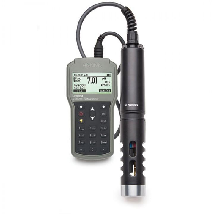
- HI-98194 Multiparameter Waterproof Meter
Used to measure and record various key water properties such as: pH/mV, ORP, conductivity, TDS, resistivity, salinity, dissolved oxygen, Atmospheric pressure and temperature -
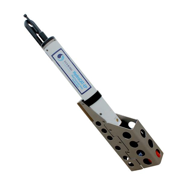
Sea-Bird Scientific HydroCAT-EP sensor sonde
Used to measure and record various key water properties such as: temperature, pressure, dissolved oxygen, conductivity, pH, turbidity and chlorophyll -
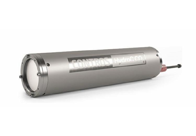
CONTROS HydroC CO2 (on loan from the Marine Institute)
CO2 flow through sensor for underway (FerryBox) and lab applications -
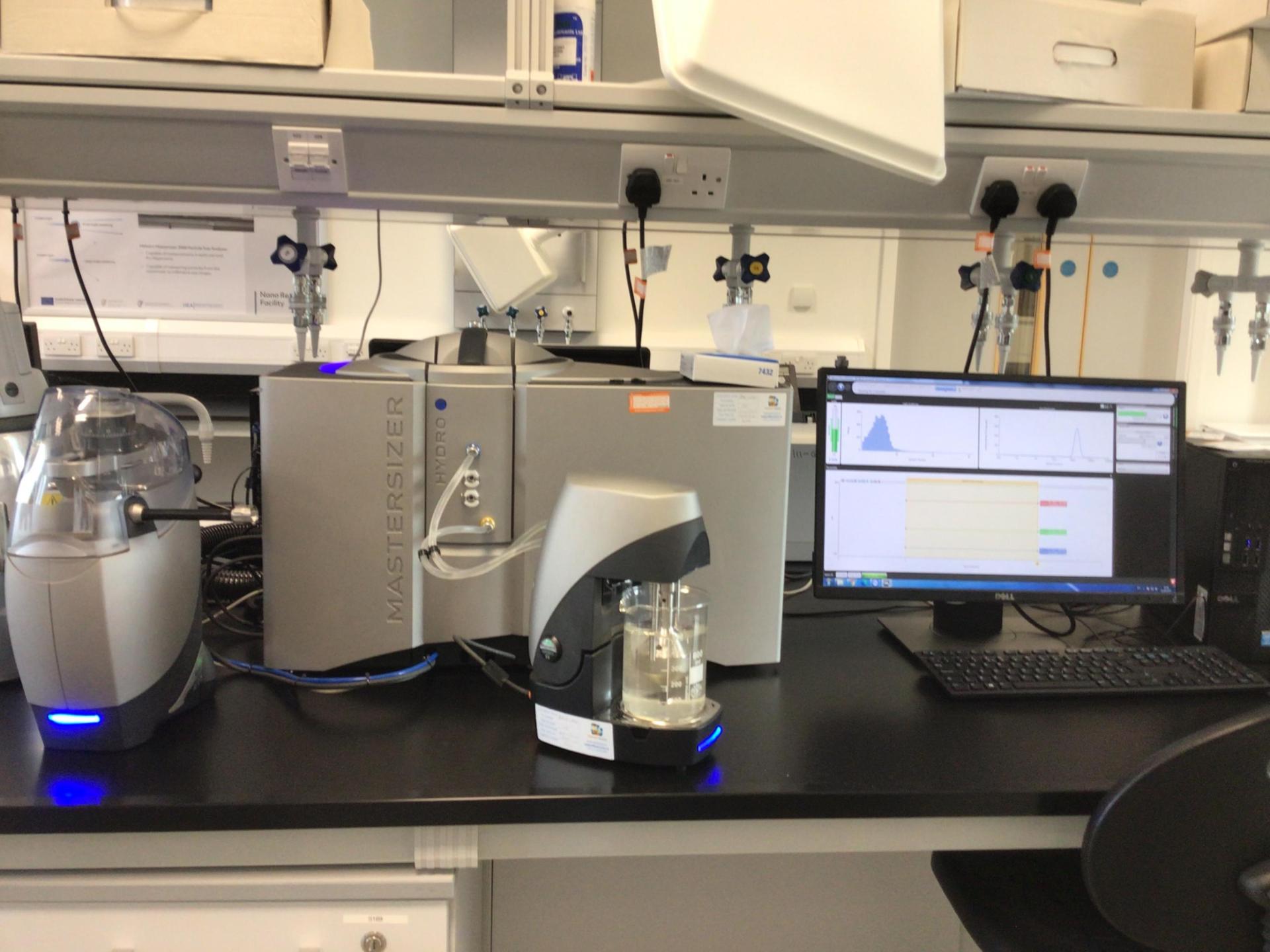
Malvern Mastersizer 3000
A laser diffraction particle size analyzer that can measure particle size distributions for both wet and dry dispersions. It is capable of measuring particles from the nanometer to millimeter size ranges. It does this by measuring the intensity of light scattered as a laser beam passes through a dispersed particulate sample. This data is then analyzed to calculate the size of the particles that created the scattering pattern.
Remote Sensing
-
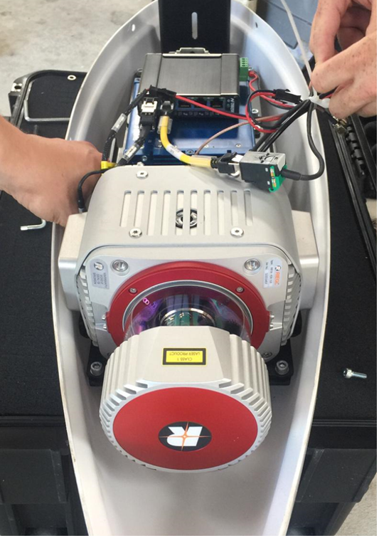
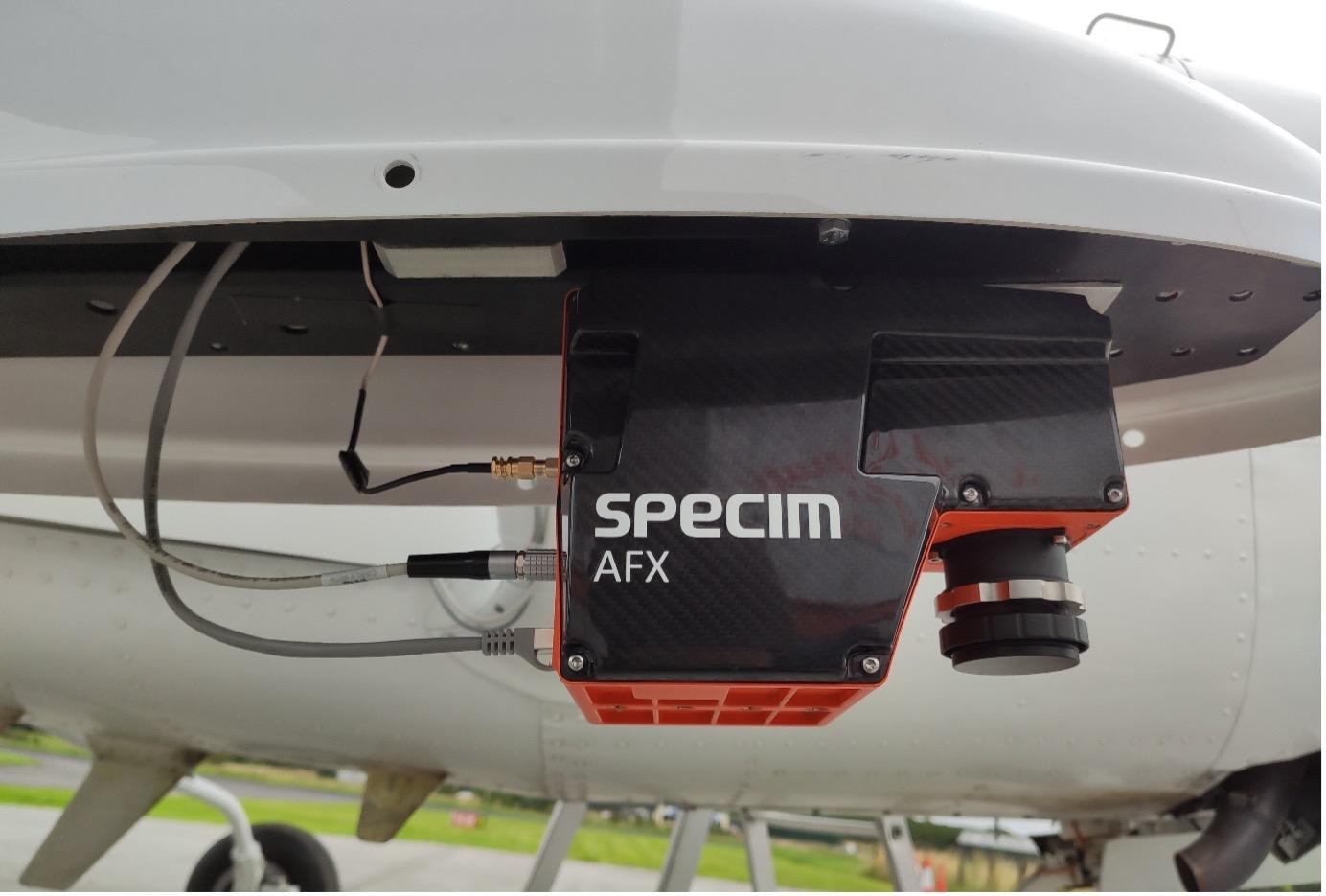
SPECIM AFX10 Hyperspectral Imaging Camera
The SPECUM AFX10 is a hyperspectral imaging camera flown on both aerial and drone platfroms by the MU remote sensing group on PREDICT. This sesnor has been used for water quality surveys in Dublin Bay as part of PREDICT. -
REIGEL VUX-1 LR LiDAR Scanner
The REIGEL VUX-1 LR is a survey grade LiDAR scanner flown on both aerial and drone platfroms by the MU remote sensing group on PREDICT. This sensor has been used on an aerial patform to survey eight key beaches, in the Dublin region, for coatal erosion as part of PREDICT. -
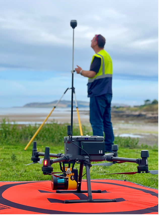
YellowScan Surveyor Ultra LiDAR Scanner
The YellowScan Surveyor Ultra is a LiDAR scanner flown on drone platfroms by the MU remote sensing group on PREDICT. This sesnor has been used to survey Portrane Beach for coatal erosion as part of PREDICT. The sensor is seen mounted to the DJI Martice 300 RTK in the image above. -
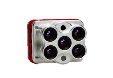
Micasense ALTIUM Multispectral Camera
The Micasense ALTIUM is a Multispectral Camera flown on both aerial and drone platfroms by the MU remote sensing group on PREDICT. The sensor posesses six spectral bands: blue, green, red, red edge, near infrared, and thermal.
Weather Station
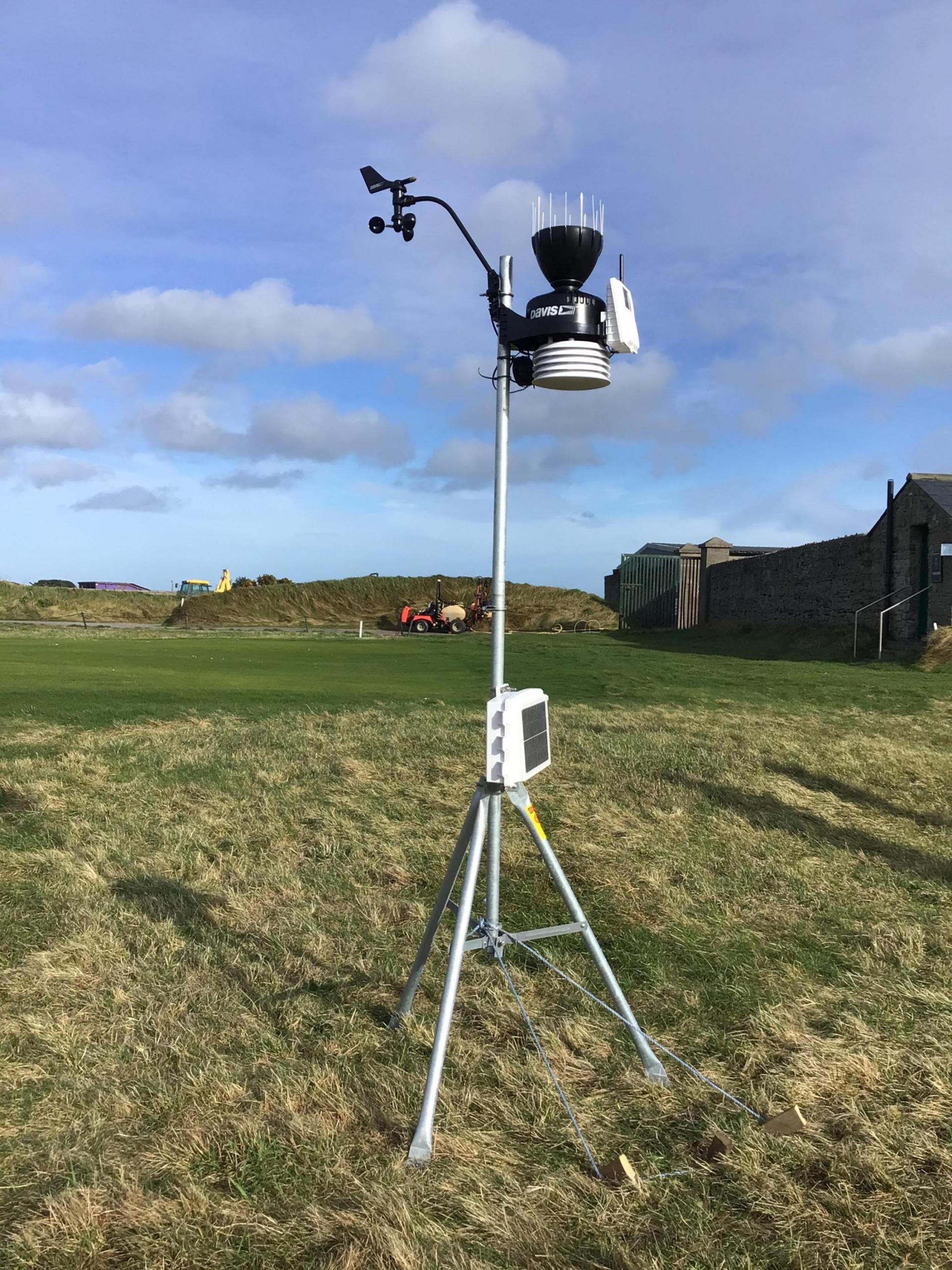
- Davis Vantage Pro 2 Weather Station
Data that is recorded includes wind speed, wind direction, temperature, humidity, wind run, wind chill, heat index, air pressure and precipitation.
Outsourced Infrastructure
-
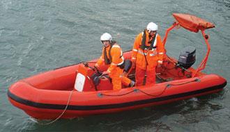
5.85 Metre Console Controlled RIB (Rigid Inflatable Boat)
On loan from Dun Laoghaire Powerboat School
http://www.powerboatschool.ie